Wednesday, December 9, 2020

Olympus

The obsession that taunted. Incessantly probed and prodded. Reverberating in the caverns of the nervous system.  Calling. Calling. Calling. One who has fallen in love with the isolated coastal range could butcher words about the mystique, awe, and beauty til the mountains disintegrate into the sea. But more deserving of this shower of vocabulary than any other area of the Olympic Mountains is the heart of the range.  Olympus. Its blanket of ice and snow splayed over the rocks like a giant white octopus. Above this a crown of black prominences. Jagged jaws that split the clouds carried off the Pacific Ocean.  The crevasses and bergschrunds yawn viciously as the summer melts the snow away.  The years of heavy winter accumulation satiate the icy tombs. The cold breezes blew off the expansive glaciers and chilled the morning air as I raced along the Hoh River Valley. 

   
  Over root and rock.  Weaving back and forth between old growth trunks.  Thick beasts laden with moss and fern.  So tall that the tops are hard to find.  The breath heavy and rhythmic.  The axe bouncing. Clink. Clink. Clink.   A hurdle of a log. A bridge over a creek. Wet feet in a frigid stream. The roar of a glacial fed river.  


A repetition. 5 days ago I had done this same excursion.  Rainforest. Ice. Rock. Repeat.  I hadn’t really told anyone about it. Keeping it secret like some nefarious affair. What was it that brought me back?  The competition? Running the fastest time on the route is enticing for one with a competitive spirit.  But something else gripped me.  There is no awards for running the fastest time.  Extrinsic motivation played little of the role. For what do bragging rights bring you at the end of the day? Some numbers on paper. The land will fall away.  The ice will melt. The forest will burn and rot.  Your physical being will do the same. And there will be renewal. Obsession? Addiction? That feeling of flow? Where every foot step you take feels like the most important step you’ve ever taken.  As close as one can get to flying without metallic wings.  A little closer to the point.


    The truth is I had fallen in love with the land and moving through it.  The resilient animals and plants.  The gritty dirt and mud.  The barren rock and ice.  Extremities experiencing it all. Hands and feet propelling me through space.  Senses fully attuned.  The breath expanding the lungs til nearly bursting.  I had come back because I wanted more of it.  And probably even needed it.  I would probably crawl down that trailhead 100 feet in my elderly years just to bring back that feeling.  And cast off the weariness of old age for just a moment. Just to bring it back.  And that’s why I was here now.  The Love.  That all encompassing feeling. That has the potential to bring one to doom or enlightenment. 


    The forest wizzed by.  An early morning blur.  Waking at 5AM I was barely awake to perceive the passage of time.  Through the temperate rainforest.  In all its glory of greenery.  A short  section of rocky alp land and on top of the lateral moraine.  There the titan standing tall in its glory.   Across the plains of ice and snow of blue glacier.  Crampons and axe ready.  My eyes were transfixed.  A line up the ice falls.  I was called in.  The siren song drowning out the fear.  I will never be able to describe why my body was magnetized in that direction.  There was danger.  I had inadequate gear. Only the cheapest my measly income could bring me.  My experience was lacking. But still I went. My instincts taking control.  


     I climbed up. On less than vertical snow and then ice and snow and ice.  A few steps of ice.  The line up the wall led to an area of less slope between the two tiers of ice falls. I was in a land of incomprehension.  The seracs and ice features stunned me.  My jaw down to the ground.  My eye sockets wide enough to let the balls roll out.  I kept moving. I stepped on ice boulders the size of cars.  One moved slightly under my feet.  And as if out of a trance I was reminded of my own mortality.   Why am I here? Why am I here? Why am I here? Panic seized me.  Spiraled me down, down, down.  Into a pile of blubbery mush.  Love bringing one to their doom?  


     The breath brought me back.  Big diaphragmatic ones.  I am here. I am alive.  Now what the hell are you going to do about it? Determination propelled me out.  I aimed for the upper wall.  A giant wall of ice on one side that planned on calving off in a distant future and the main upper block of ice.  I spidered my way through.  The walls close enough together that I could split my legs across. One crampon planted on one wall the other the opposite.  My axe prying for holds.  My friend would have sarcastically said I think I read about that move in the freedom of the hills.  I moved slow. My mind was over taken with the task. Slowly I moved up.  I came to an opening that peered out over the undulations of ice.  The most beautiful river of ice.  A sight I had only seen on video when planes fly over seracs and ice falls.   I moved right into a crevasse becoming a spider again. The opening in the ice tapering down into a tightening hole.  I would not be swallowed during a fall but the scrapes from the ice would tatter my cloths and my skin. Up and up I inched out.  I made it to a gentler incline of a mix of snow and ice.  The last of it a small step.  I planted the handle of my axe all the way in and heaved myself out. On top of the upper blue glacier.  I was elated.  I had maneuvered myself through a maze.  Climbing in an unorthodox fashion.  A rope and some ice tools would have been nice.   Both my grandma and I would agree on the stupidity of my actions. And the threat I had posed to my self preservation.  


      After that everything felt like a walk in the park. I looked at the way to the summit.  A team of 3 that were roped up moved across the expanse.  Probably wondering who this damn ice mole was that popped out of his subterranean layer.  I took the 4th of July route.   A steep snow slope and some rock traversing to avoid the bergschrunds and I was at the summit block.  I reached the summit in just over 6 hours. Still pretty good even though I had spent all that time in the ice labyrinth contemplating my life decisions.  I moved down efficiently and fast. Rock. Ice. Rainforest.  


     I pushed harder and harder.  The less technical the faster I could move.  The desire to run faster than I had before.  Getting closer to 10 hours.  The rainforest again a blur in my periphery.  So thirsty that I didn’t even care how many elk shit in the streams I was drinking out of. My eyes darting back and fourth reading the trail.  Mapping out the dance floor for my feet.  I pressed the intensity. A 7 minute mile. A sub 7 minute mile.  3 miles. 2 miles.  I made it back to the car. Gassed. Fried.  Toasted.  My body quivered. Gasping for breath. I felt on the verge of a panic attack.  It took some time to calm down.  The celebratory beer as always.  Nice to be tipsy during the ritualistic icing of the legs in the river you just ran up.  What was it again?  Love bringing one to enlightenment?  Hell, just call it a near life experience and be satisfied for once.  Indeed I was in a state of bliss and I will always desire that feeling again.


Mount Olympus

West peak elevation: 7979’

Mileage: 45 miles

Elevation gain: 10000’


I had 4 successful summits on Mount Olympus. 2 occurred in the summit of 2018 and 2 in 2017.  I had one failed attempt on the summit in 2018.    I spent approximately 57 hours on this route over 5 attempts. The mileage spent over 5 attempts is approximately 225 miles and the elevation gain 50000 feet. 


July 19, 2018. 4th of July Route.  Summit achieved.  Start and finish at the Hoh Visitor Center.  Total time: 10 hours 33 minutes 19 seconds. 

https://www.strava.com/activities/1714272359


July 14, 2018. Crystal Pass Route. Summit achieved.  Start and finish at the Hoh Visitor Center.  Total time: 11 hours 37 minutes 44 seconds. 

https://www.strava.com/activities/1703059173


June 16, 2018. 4th of July Route. Failed summit attempt.  Start and finish at the Hoh Visitor Center. Total time: 12 hours 52 minutes 50 seconds 

https://www.strava.com/activities/1643067929


July 17th, 2017. Crystal Pass Route. Summit achieved. Start and finish at the Hoh Visitor Center.  Total time: 10 hours 23 minutes 21 seconds 

https://www.strava.com/activities/1088702213


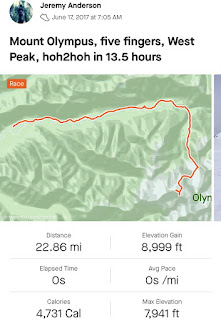
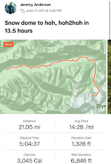
June 17th, 2017. Crystal Pass Route. Summit achieved.  Start and finish at the Hoh Vistor Center.  Total time: 13 hours 30 minutes 

https://www.strava.com/activities/1041831565


https://www.strava.com/activities/1041633577


Wednesday, November 20, 2019

100 Kilometers in the Olympic National Park

100 Kilometers in the Olympic National Park

August 14th, 2016


Having trodden many of the trails in the Olympic National Park, an idea simmered in my mind involving some of the most rugged sections. After two weeks of late-night staring contests with my Olympic National Park map, I devised a loop. After a four hour nap, I started at Obstruction Point around midnight on Sunday. I ran down the road back to Hurricane Ridge, then I dropped down to the Elwha via Wolf Creek Trail. Witching hour was living up to its name. The forests were dark, eerie, and full of silent watchfulness. The eyes of a small bobcat, illuminated by my headlamp at Whiskey Bend, only encouraged the spooky feeling that time of the night brought. As I ascended up to Dodger Point, the west peaks reflected the spectrum of early sunlight - which lightened the mood. A buck with its thunderous hop was the only sensation that brought my mind out of the hypnotic state of climbing. As I approached the last half mile, my eyes were agape as they saturated with Mount Olympus and the Bailey Range. I arrived at the Dodger Point Fire Lookout as the sun rose, shining bright on the surrounding ridges and mountains.


The navigation became difficult after proceeding off Dodger Point to the Elwha. The trail is a well maintained deer trail closed in by undergrowth. I circled for 30-60 minutes as the trail merged into a meadow and became an elusive path to follow. As I descended, I wondered multiple times whether I had to navigate a labyrinth of untouched forest down to the Elwha River. Solace filled my marrow as I spotted an orange tag on a tree, the universal sign of being back on track! After that, the descent down to the Elwha ford was pleasantly steep with the reassuring whip of salal on every stride. The river was marvelously cold on the feet and a relief from the heat and friction that builds up on steep descents. The Elwha Valley is the epitome of picturesque Olympic National Park river valleys. Green moss, walls of trees, and mushrooms misting the air with spores.


A left turn up and out of the valley leads into a pine forest. As the elevation increased the temperature decreased. Soaking my hat in every creek helped lessen the onslaught of the sun’s radiation. Hayden Pass is not too steep but lasts 8.4 miles; the word slogging comes to mind. Hayden Pass is out there, but once you arrive, you don’t want to leave. The view of Mount Anderson massif with its peaks surrounding Eel Glacier entices one up the ascent.
Mount Claywood and Sentinel Peak form the gateway that welcomes into the Dosewallips River Valley. The descent off Hayden Pass is a memory preserved deep in my mental vault to return to when hopelessness reigns over my being. On the first switchback, Sentinel Peak exposes its massive, glistening scree fields.
A left turn down another switch back points straight at Mount Claywood, standing tall as a wave about to crash upon the rocks. 
Creeks and waterfalls are hopped, skipped, and jumped over. The mood is light, frolicking through the flower filled meadows. The 1000 foot climb in .9 of a mile to Lost Pass contrasts sharply with the elevation of the previous descent off of Hayden Pass and nature frills. Roots, dust, and more roots create a cedar scented staircase that elevate me off the valley floor. 


At the top, the Lost Pass sign stares with defined numbers, 5-5-5-0, welling up a sense of accomplishment as the lungs are being sucked down into the diaphragm. 


Cameron Pass looms up ahead and Lost Peak cliffs crumble into scree field, giving it the look of a mountain worn down to the bones. 


A peak of euphoria at the top of Cameron Pass floods my veins. Wishing I could stay a while and scurry on the ridge crests like a squirrel on a power line. 


The descent had the potential of turning into a scree party if I was in better shape. Hamburger feet don’t make good scree ice skates. The disappointment in a lack of scree bombing was minimized by the splendor of Upper Cameron Basin. 


Head Cameron lays like a massive old dragon that has shed its scales around its tired frame. Snowfields and small runoff streams feed into the winding Cameron Creek below.


I descend, pushing into the valley. Cameron Creek trail is overgrown and my mind reminisces movies with dense jungle and machete wielding adventurers. Just before I give up hope and turn around to search for the lost ascent trail, I find the junction. Another escalator, up and up. More crawling snake root staircases and more breathing in the air as fast as the evergreens around me can make it. Grand Pass welcomes along with the golden hour. 


Grand Valley lies ahead, past an icy lake and a descent like the swoop of a hawk. Coming down the rock staircases to Moose and Grand Lake tear up my left iliotibial band, which reduces me to trading off between stiff legged running and walking. The darkness settles in and I ascend to the top of the climb. I feel like a knuckle dragging ape climbing a hill after being exiled from the troop. Dark thoughts accompany the enveloping night. Beneath a star-lit canopy, all the regrets, what-ifs, and fixations on expectations are created and destroyed, persisting and cycling through my tired brain. The top of the ridge brings the comforting thought: “we are close”. My shuffling run/walk eventually brings me back to Obstruction Point. A massive buck stands next to the end of the trail, observing. My feet are relieved. I feel like victim of alien abduction. Did that just happen? Was that an actual occurrence? Around 69 miles and 20000+ feet of elevation gain. Exhausted, I crack a beer. What now? 


The Bailey Range Traverse

The Bailey Range Traverse
August 19th, 2017

My interest was piqued. Chatting after a 50k race that circumnavigated Mount Saint Helens, the man sitting across from me said, “I heard it’s a long 24 hours”. Others warned of at least a three to four day trek. A friend had bailed off a month ago due to snow. Indeed, another journey, another day. How long would it take? How far was it? The unknown. Two weeks later I was getting out of bed at one in the morning and headed for the trail head. The plan was to start at the Sol Duc and finish at the Sol Duc - traversing the Bailey Range to Mount Olympus, continuing on to the Hoh River Trail and climbing up the Hoh Lake Trail back up to Seven lakes Basin, and from there back to Sol Duc. 

I started up the Sol Duc River Trail and considered the long day to come. Still half asleep, grogginess permeated my consciousness as I forged through a tunnel of old growth trees illuminated by my headlamp while the rhythmic beat of my ice ax bounced along with my body's undulations. Time sprinted by. Before I knew it, the early dawn started to distinguish ridges and shapes on the dark landscape around me, while the crescent moon relaxed herself into the horizon.


Ascending to the sub alpine; heather and fir trees sprinkled in tiny orbs of dew. As I climbed up toward the High Divide, I gazed down on Heart Lake. Half shaded by trees and gently illuminated by the light of the rising sun.
Continuing to the crest of the ridge line, the trail meandered through the trees and heather meadows, making way to the cat walk along the ridge. The path became an ascending sin wave staircase of root and rock. The shoulder of Mount Carrie lifted me to the sky. Meadows reduced to sparse patches of grass intermingled among scree fields. My sight drifting down, admiring the marine layer crawling up the Hoh River Valley from the ocean.


I dig in. Claws up front grasping to occasional solid rock, searching for any purchase on loose scree. Toes finding a stable island of rock or sinking into soft slope. Getting one step up while losing two precious steps back to gravity. The glorious sight of the sun taunts from the opposite side of Carrie. Almost to summit, almost to warmth, almost to waking light.


The summit of Mount Carrie. Views expansive, flooding my consciousness. Vivid memories imprinted that I wont forget. A glimpse of remoteness. That feeling is a very rare occurrence. Out there - further. The Bailey Range sprawling and undulating. Expanses of rock and snow. A heavenly trail above the primeval rain forest. To the south, Olympus Massif, a standing kingdom of white shattered by protruding black crags. The distance to the Massif a lifetime away. After a break for water and food, I don glacier glasses and microspikes and step onto Carrie Glacier.

Following along the snow ridge in the middle of the glacier that leads a curved route that traverses below Ruth Peak... Ruth entices. A route to summit? I decide no. Knowledge of the route is lacking I've got many more miles to cover in very little time.


Onward I march to the steep eastern finger of Carrie Glacier. 

Cracked ice glistening in the sun. Snow melted off the steeper section of the glacier incites a decision: with only the microspikes, climbing up the solid rock to the right of the glacier would be a safer route.


I climb up glacier-polished rock. Hand holds are sparse. Hitting a difficult patch, I splay out on the smooth dome of rock, reaching. My body finds tiny protrusions allowing ascent. Success! After that, easy and loose rock lead to the sun-baked snow field above.

I eye the ridge crest for the gully descending to Stephen Lake. Peeking my head through the gaps between the rocky spires for the descent.  I follow a ramp that descends down to loose rock and snow fields. I glissade down the snow fields as far as possible. The wide open gully funnels down into a creek that cuts down to Stephen Lake. I hop from rock to rock along the cascading creek bed, less difficult than navigating the loose, steep scree slopes.


The creek disperses across a delta into tiny streams of water all finding their own rambling path to the azure lake.

Ascending Mount Stephen, I stick to a snowfield to avoid the frustratingly loose scree. Eventually, the scree is the only option. The climb is steep and long, one of the biggest of the day. I finally reached the top of a broad ridge a few hundred feet below Mount Stephen. Still holding a reservoir of energy, I make a small detour and find the jagged summit of Mount Stephen.

The descent is gradual on the ridge. Snowfields and rock are traded for trees and meadows. I follow trails. They are so faint it is hard to tell whether they are game or faint paths left by past traverses. I stay up high, and when a view of Ferry Basin appears, I descend. The view is picturesque. A network of streams and game trails meander through the heather and stunted firs. Alpine pools and streams glisten in the midday sun. What a paradise.


I linger for a while taking in the heavenly basin. I eat some much needed nutrition and wash it down with a small stream running off the snowfields of Mount Ferry. I climb a short snow field and a gently sloping ridge up to the summit of Mount Ferry. On the descent, the view to the right is a beautiful lake, still coated in snow and ice even in August.


I skip Mount Pulitzer this time. Skirting around on its east shoulder and descending down to Lone Tree Pass. I search for elk in Goldie Basin, but there are none to see.

I descend down a bare ridge off of Pulitzer Pass. Eventually returning to snow. I travel through a gully with the Urchin and Ragamuffin to the left. The names are fitting. Sharks teeth, devil's fangs, and demon talons would all be suitable names. I move over sun holes and snow crests making my way toward Mount Childs. After ascending up a ridge of snow I am surprised to see two humans making there way across the traverse. They are probably just as surprised. They have just come up from the Elwha Snow Finger and they say that it is nonexistent this time of year and a horrendous path without snow, a maze of slide alder and steep slopes of loose rock. Sounds like a typical bushwhack in the Olympics.


I approach the summit of Mount Childs. My thighs growing heavier as I ascend over loose rock interspersed with jagged chunks. I reach the apex and admire the sharp needled peaks below.

Bear Pass glacier is only a mile and a half away and I make my way over rock and snow towards it. Once on the glacier I realize how tired I am. My feet sinking into the sun-cooked snow encourages my growing fatigue. At the top of Bear Pass glacier I overlook the glorious Queets Basin. Remote as all hell. Has anyone been here? Gray and black rock spotted with white snow patches. Mount Barnes stands out, her snow fields glinting in the sun. Many tiny streams accumulate into the headwaters of the Queets River. I descend easy terrain into the basin and make my way past cascading creeks, rock, and mounds of heather.


Stepping off the scree and rocks I enter a meadow. I spot a bear meandering around down below, looking for whatever a bear looks for. He pays no mind to me. I head for low brush clinging to the hillside. Traversing towards Humes Glacier I start to have trouble in the brush. Steep, steep, steep. I cling to brush and branch. I even bring out my ice ax to grip the steep hills. I find a rotten tree torn to pieces by a bear and the biggest pile of bear scat I’ve ever seen. I have to descend and ascend two steep ravines still using my ice ax on the loose slopes. Frustrated and sun burnt, I did not want to deal with route confusion this far in. After descending the last ravine, I find myself staring at the north drainage of the Humes Glacier. I maneuver through the drainage, a maze of boulders and rocks smoothed by glacial movements. I climb up slabby rock ledges and view the sprawling glacier with a silty lake at her terminus. The glacier resembles a dirty ice cube. I walk up easily with my spikes on bare ice, happy that there is no soft snow, no crevasses. Tiny rivulets run down grooves in the glacier and a few small moulins dot the surface.

I climb over Blizzard Pass and make a detour. I climb Circe for my last summit of the day. The sun descends through wispy clouds. The rocky peaks of the Olympus Massif silhouetted in front of blue sky and golden sunset.

I move down snow fields to the Hoh Glacier. For a split second, anxiety that the route does not go makes my mind whirl. A symptom of weariness and low calories. Of course it goes through, and I eke out a whoop.


I maneuver slowly through the cracks of the Hoh Glacier being cautious, and marvel at the rock of Mount Mathias towering regally above the ice.

I climb over Glacier Pass from Hoh to Blue Glacier. I watch small blocks of ice clatter down the ice falls.


The sun drops behind the blue ice and the sky turns orange. I feel a surge of energy, the end of one leg of the journey done. I run down the gently sloped Blue Glacier and jump the two foot wide crevasses.

I make my way to the lateral moraine, the end of the glacier covered with dark rocks and rough ice. I get to the top of the moraine and look back at the glaciers and rocks. Ice ax and spikes away, jacket on. I take a quick 15 minute nap under the orange sky. 


I wake up, eat a few dates, and continue on. Through the dark I move down the Hoh river trail feeling a relief to be back on easier trail. Easier terrain. Easier route finding. Weariness takes over. I only make it to the Hoh Bridge before another 15 minute nap is needed. I set the timer and lay down with the roar of the river below me. I wake up before the alarm, something startling me into consciousness, and keep moving. 

I turn right on to the Hoh Lake Trail and start my long climb back to Seven Lakes Basin. I make it a mile before my drunken stumbling and head spinning bring me to the ground for another dirt nap. I take a few more during the climb, each nap limited by getting so cold I would wake up. The climb is relentless. The longest climb of my life, 4000 feet up from Hoh River to Hoh Lake. A spiral staircase of switchbacks that make me dizzy, coercing me to another nap. I’m finally at the top. A pleasant summer wind blows as I follow the dark trail home. I make an attempt to search for mountain blueberries, but the search is further exhausting me and I only nab a few. I pass lupines and open meadows, painted in darkness, sleepy and covered in dew. The last few miles is a hobble. I stub my toe, but it feels like my whole foot, over and over. Weary legs barely able to pick up my feet which have turned to lead. More switchbacks. More rocks. Through the forest, a gentle gray light blooms slowly. I hear the roar of the Sol Duc Falls. More switch backs. Will those damn falls ever appear? There they are! Roaring and misty. Over the bridge. Clank clank the ice ax bounces again. The trail smoother now from the many day hikers that eye-ball and paparazzi the misty falls. Another root to the toe and another rock. And the finality. One dedicated loop around the parking lot to make it 60 miles even. A drink to relax the mind, but it doesn't put a dent in my mind, blown. Just to take that edge off a little. Nostalgia already growing. I knew that this was a very good day.